
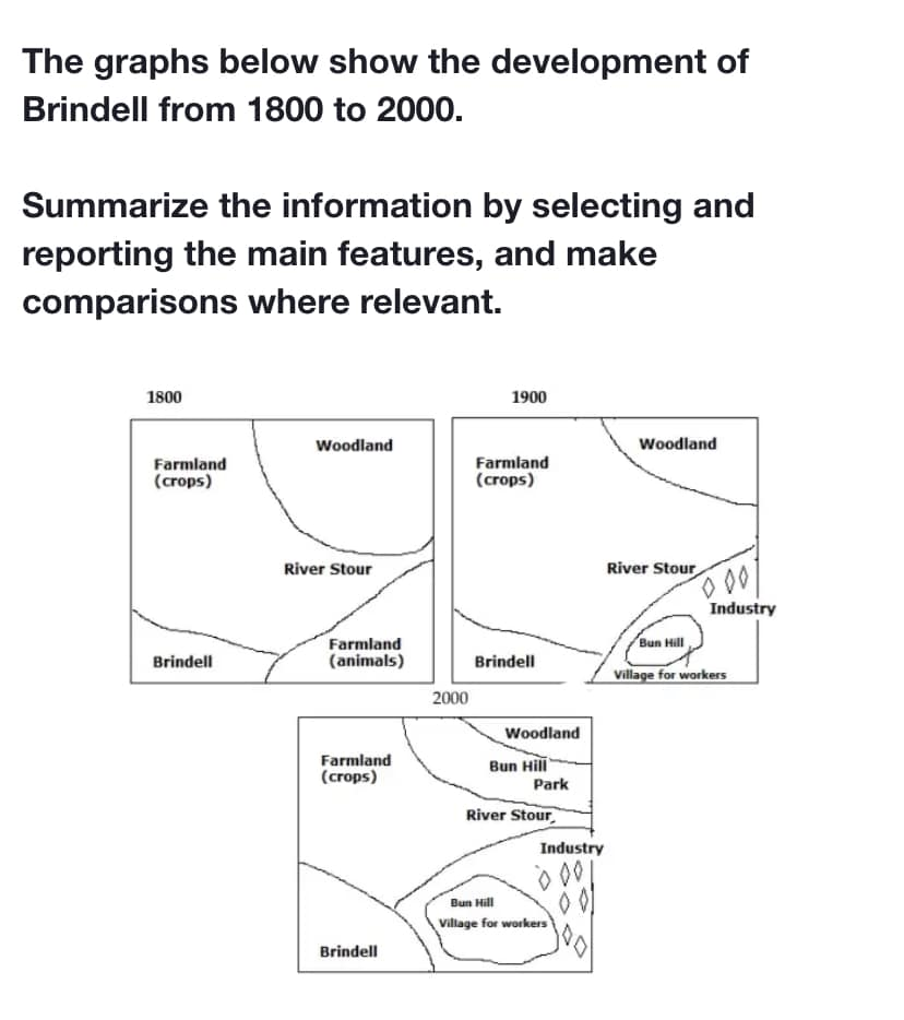
[Maps] The graphs below show the development of Brindell from 1800 to 2000
Plan:
Overview – many things changed, it became more multifunctional
Body 1: Listing out all the parts of the town and the surrounding areas
Body 2: Show how each part changed throughout the years.
The map below depicts how the town of Brindell and its surrounding areas developed over a period of 200 years. Overall, the entire area underwent massive changes over time, turning Brindell and the neighboring sectors from an agriculture-oriented town into a more multifunctional area.
In 1800, Brindell was shown located in the southwest of the region, bordering two massive farmlands which were separated by the river Stout. The northern agricultural zone was used for crop cultivation while the southeastern one was a pasture for animals. Both were adjacent to the woodland, which could be found in the northeast.
A century later, there were little change to Brindell, but it almost doubled its original size in 2000. Next, while the crop-growing farmland kept its function and dropped significantly in size, the animal farm was cut down to accommodate the Bun Hill Village for workers and an industrial estate. The village and industrial zone continued to expand noticeably by the end of the period. Finally, the woodland area had shrunk by almost half in 2000, and it was then surrounded by Bun Hill Park.
(182 Words – Band 8.0)

Responses