
[Maps] Islip Town Center Development
The maps show the center of a small town called Islip as it is now and plans for its development. The provided diagram illustrates Islip…
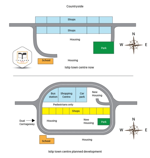
The maps show the center of a small town called Islip as it is now and plans for its development. The provided diagram illustrates Islip…
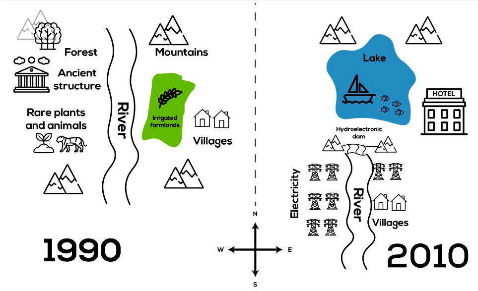
The maps below show the changes in a town after the construction of a hydroelectric power dam. The provided maps depict the transformation of a…
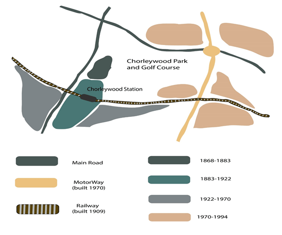
Chorleywood is a village near London whose population has increased steadily since the middle of the nineteenth century. The map below shows the development of…
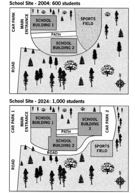
The diagrams below show the site of a school in 2004 and the plan for changes to the school site in 2024. The two pictures…
Plan: Overview – many things changed, it became more multifunctional Body 1: Listing out all the parts of the town and the surrounding areas Body…
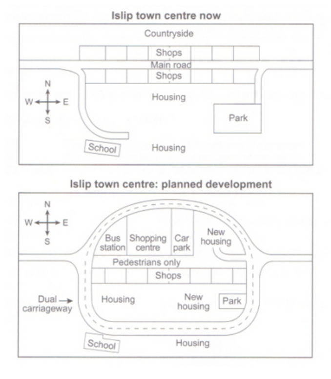
The maps below show the centre of a small town called Islip as it is now, and plans for its development. The diagrams present proposed…
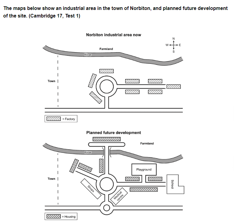
The provided maps depict the current state of Norbiton industrial site and its proposed redevelopment. Overall, while this town is solely being outfitted for manufacturing…