
[Maps] The maps below show the centre of a small town called Islip as it is now, and plans for its development
The maps below show the centre of a small town called Islip as it is now, and plans for its development.
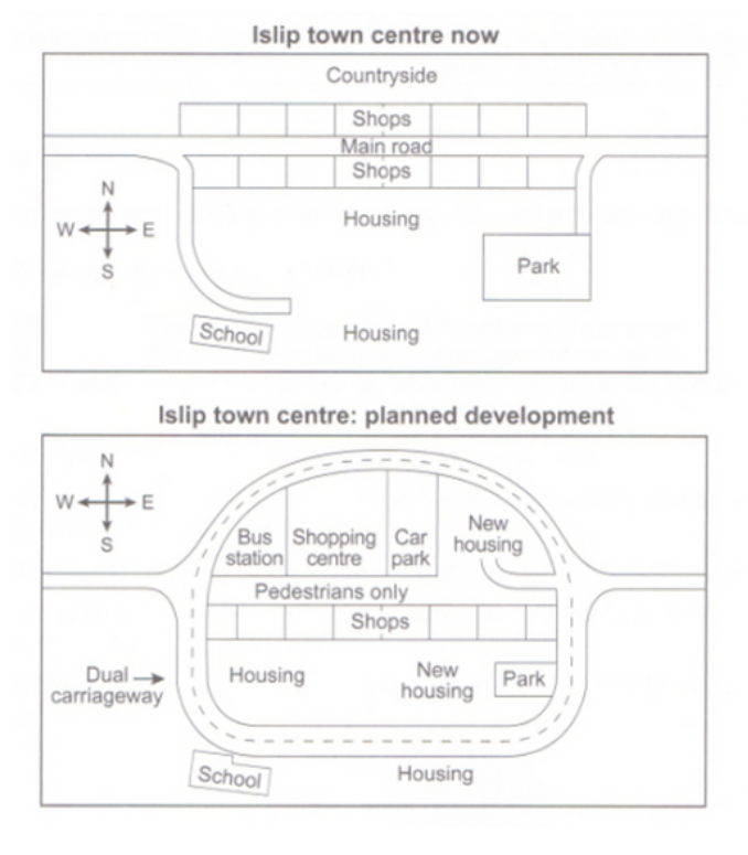
The diagrams present proposed changes to the central area of Islip town and its current plan. Overall, one of the primary modification of the town will include the construction of a ring road which encircles the center, accompanied by various other developments related to shops and housing.
Currently, the central area of Islip is traversed by a main road running from east to west. However, according to the second map depicting the proposed changes, this main road will be reserved for pedestrian use. Instead, traffic will be redirected onto a dual carriageway forming a ring around the town center.
Notably, the planned pedestrian street will necessitate the demolition of shops along the north side to accommodate a bus station, shopping center, car park, and new housing area. Conversely, the shops along the south side will remain intact, although it appears that the town’s park will be downsized to make room for additional housing within the ring road.
(157 Words – Band 8.0)

Responses