
[Maps] Changes to a town after dam construction
The maps below show the changes in a town after the construction of a hydroelectric power dam.
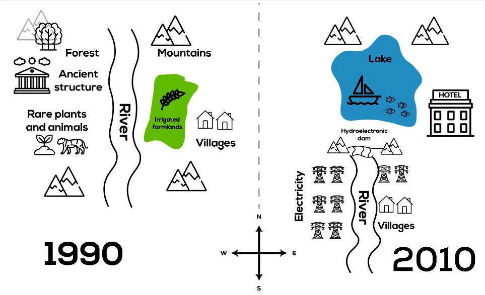
The provided maps depict the transformation of a town following the erection of a hydroelectric dam. It is evident that the hydroelectric dam brought about vast changes to the area, especially to the facilities and landmarks on both sides of the river. Despite this, the mountain ranges in the north remained untouched.
In 1990, the township was situated within the boundaries of 4 mountains, and a river flowed through the area from north to south. On the western bank of river laid a forest, an ancient structure, and rare flora and fauna were also found here. The opposing bank was home to some irrigated farmlands, which directly bordered the river, with some villages to located eastward.
20 years later, a hydroelectric dam was shown to be constructed between the base of the two southernmost mountains, which split the region into two. The majority of the original township was removed, with the exception of the villages being relocated to the southeast, beyond the dam.The upstream part of the river was in 2010 home to a lake, which could be used for recreational purposes, and a hotel. Moving further downstream, electrical grids were erected along both sides of the river, with some bordering the relocated villages.


Responses