
[Maps] WT1 Sample: Norbiton Development (14/10/23)
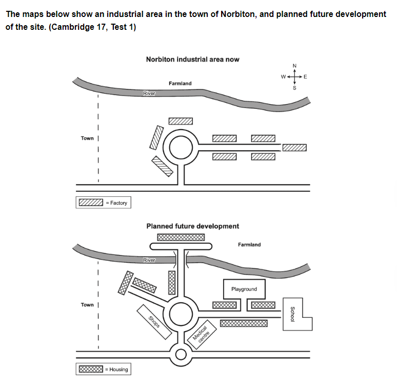
The provided maps depict the current state of Norbiton industrial site and its proposed redevelopment. Overall, while this town is solely being outfitted for manufacturing purposes, it will be remodelled into a residential neighborhood according to the projected plan.
To start, the centerpiece of Norbiton is a sizable roundabout connected to 2 main roads, one to the South and the other to the East. Surrounding the roundabout and along the Eastern road are blocks of factories facing a river and farmland. To the West of Norbiton is currently a town, which can be reached by the Southern main road.
In terms of the planned development, a second, more modest roundabout is to be constructed right to the South of the main one, which would border a medical center to the East, and shops to the West. Housing areas will be erected in all directions, even across the river, and they will be connected to the roundabout via roads. In addition to this, Norbiton will be home to other facilities, such as a school and playground, but they will be situated in the Eastern part of town.
Word count: 186 – Band 8.0


Responses